


 19 / 60

19
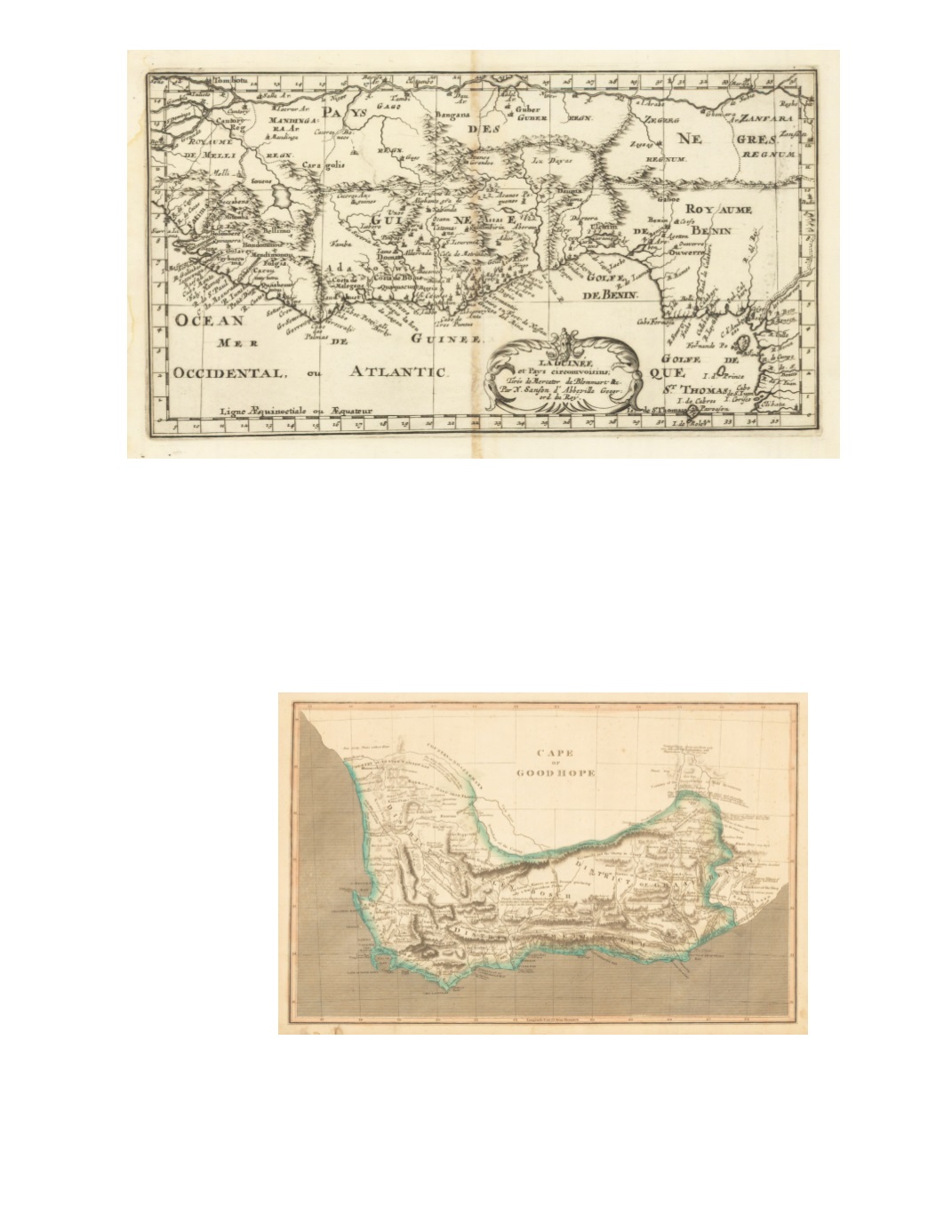
32) La Guinée et Pays circomvoisins; Tirés de Mercator [,] de Blommart &c By: N. [Nicolas] Sanson d’Abbeville Date: 1656 (Dated) Paris Dimensions: 6.5 x 12 inches (16.5 cm x 30.5 cm) This seventeenth century map displays the southern coast of West Africa from the coast of Sierra Leone around to Gabon, including São Thome (St. Thomas). Parts of present-day Mali and Niger appear in the north. The map shows gulfs, rivers, lakes and cities of the region, which is referred to on the map as “Pays des Negres,” or “Lands of the Negroes.” It is on watermarked paper which includes a symbol consisting of the letter H with a line extending down from its cross bar into the letter V, passing through a letter resembling an omega turned on its side. Condition: Discoloration along vertical line of the central fold and light water stain outside the left margin; otherwise a bright, clear print. $200 33) Cape of Good Hope By : Aaron Arrowsmith Date: 1807 (Dated) London Dimensions: 9.6 x 15.4 inches (24.5 cm x 39 cm) This map depicts the southwestern part of southern Africa, with hachures dramatically depicting mountains and ridges. Much interesting informational commentary appears on the map such as “Fine Pasture Country well wooded and water’d the Sea Coast abounding with Elephants”; “The White Rhinoceros plentiful in this part of the Country also Springboks, hartebeest and Elands.” Condition: Original color. Paper slightly darkened with foxing outside margin in lower left. $85