


 23 / 60

23
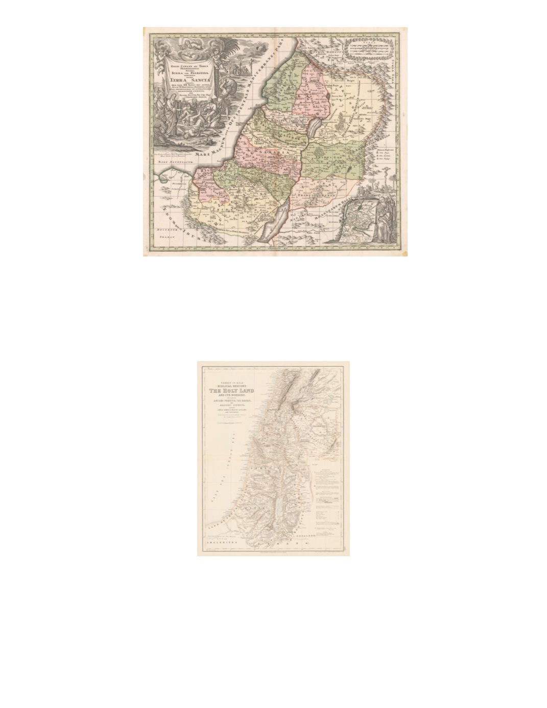
40) Regio Canaan seu Terra promissionis, postea Iudæa vel Palæstina nominata, hodie Terra Sancta vocata quæ dim XII Tribus hoc autem ævo in VI Provincias Distincta est iuxta recentissimas et accuratissimas descriptions adornata per Matth. Seutter, Sac. Cæs. Maj. Geographo Augusta By: Matthäus Seutter, Augsburg, [ca. 1729] Date: 1729 Dimensions: 19.7 x 22.8 inches (50 cm x 58 cm) A fantastic Holy Land map depicting as far south as the southern end of the Dead Sea; up north as far as north of Damascus; and as far east as the eastern side of the Jordan River. A key indicates symbols used for royal cities, priestly cities, and cities of refuge. An insert in the lower right has a map of the wandering of the Israelites in the Sinai Desert for 40 years. Condition: Excellent condition. $525 41) Turkey in Asia Biblical Regions The Holy Land and its Borders including Ancient Phœnicia, the Hauran, and Adjacent Districts; showing Jewish, Roman & Modern Divisions and Topography [In The Royal Illustrated Atlas of Modern Geography ] By : J. Hugh Johnson, Drawn and engraved at Stanfords Geographical Establishment, London Date: 1875 (published) Edinburgh, London, and Dublin Dimensions: 20.9 x 16 inches (53 cm x 40.5 cm) This map displays a highly accurate rendering of relief, shaded with hachures, and extensive, fine-grained detail of locations from the Biblical, Roman, and Ottoman Turkish periods. Dry streambeds (wadis) that only fill when there is rain are represented differently (with hachures) from rivers that always flow. Regions associated with the Twelve Tribes of Israel are marked with boxes bearing their names. A list of references in the lower right quadrant enhances readability of the map. Condition: Very good condition. $200