
26
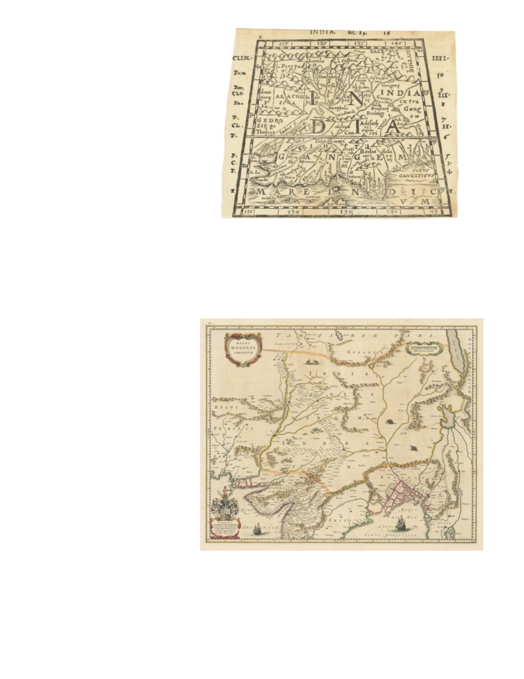
46) India. (India intra Gangem) By: Sebastian Münster Date: 1576 (Dated) Basel Dimensions: 4.9 x 5.9 inches (12.5 cm x 15 cm) This woodcut on watermarked paper is from an original map by Pomponius Mela in De Situ Orbis, based on Ptolemy’s Geographia from the 2 nd century A.D. The Tropic of Cancer is prominent near the middle of the map. Labeled in Latin, this map does not show the Indian subcontinent extending south, though it does indicate it correctly between the mouths of the Indus and Ganges rivers. Mountains are indicated, including the Vindhyas, labeled “Vindius M.” The Ganges River and the Indian Ocean are depicted and labeled. The city of Bucephala, named after Alexander the Great’s beloved horse Bucephalus, is shown. Other place names appear, but are difficult to identify with current places, posing interesting riddles to solve on this old map. Condition: Paper slightly yellowed. Margin is trapezoidal, narrowing slightly to the north, at the top. $450 47) Magni Mogolis Imperium By: Joan & Cornelius Blaeu Date: 1662 (published) Amsterdam Dimensions: 16.5 x 20.5 inches (42 x 52 cm) This fantastic map extends from Afghanistan and Persia eastward to northern Burma and the border of China, and southward from above Kabul to Bombay (Mumbai). Elephants and camels decorate the land mass on which rivers, mountain ranges, cities and major fortifications are detailed. The lower left corner features an elaborate coat of arms (with eagle, ship, horse, and bulls’ heads) topped by a helmet of armor and a cherub with drawn bow and arrow above a dedicatory panel in Latin to D. Iohanni Hvydekoper (Joan Huydecoper), lord of Maarsseveen (north of Utrecht) and Neerdijk. (He later became governor of the Dutch East India Company, 1666, and mayor of Amsterdam, 1673.) On the verso is French text, describing the origins of the Mughals, the extent of their empire, the regions they rule, the productive quality of their land, and their armed forces (including reports of thirty thousand battle elephants, eighty thousand cavalry, and two hundred thousand infantry. Condition: This map is in very good condition. Archival material reinforces the centerfold. $750


