
35
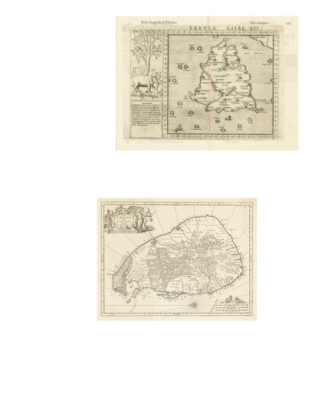
63) Tabula Asiae XII (Taprobana) By: Girolamo Ruscelli, Date: 1599 (Published) Venice, 1599 Dimensions: 6.89 x 9.45 inches (17.5 cm x 24 cm) This antique map, while small is powerful in its simplicity. The text is in Latin and Italian. The sea is indicated by stippling. A small spouting sea monster is in the lower left quadrant. There is an inset on the left with a pictorial vignette of an elephant standing in front of a tall tree. Underneath is text explaining that the Taprobana of Ptolemy is the modern island of Sumatra, a source of taller and better elephants than anywhere else, as well as being the homeland of superior pepper. On the verso is text in Italian. Condition: Archival repairs to vertical center fold as well as a few bookworm holes at very edge of lower right margin corner. $450 64) Insula Ceylan, olim Taprobana; nunc incolis Lankawn. By : Philippus Baldaeus Date: 1672 (circa) Amsterdam? Dimensions: 11.4 x 15.4 inches (29 cm x 39 cm) (Baldaeus [Baelde] lived ca. 1632-ca. 1672, died in Delft) This interesting map by Baldeus is a strong clear print oriented with east at the top. Hills, forests, palm groves, rivers, and towns are marked, but not roads. Adam’s Peak and the walled town of Kandy (Candy) are prominent. Depth soundings are given along all coasts. At the south end of the island are shown three elephants and a small figure running with a stick behind them. Small islands west of the Jaffna Peninsula are named Amsterdam, Leyden, Middelburgh, Delft, Enckhuysen, and Hoorn. Pearl banks appear south of the Island of Mannar (“Manaer”) off the northwest coast. The decorative title cartouche is in the upper left quadrant and in the lower right is a compass rose radiating rhumb lines. Condition: The map is in good condition with toning around the edges. SOLD


