
38
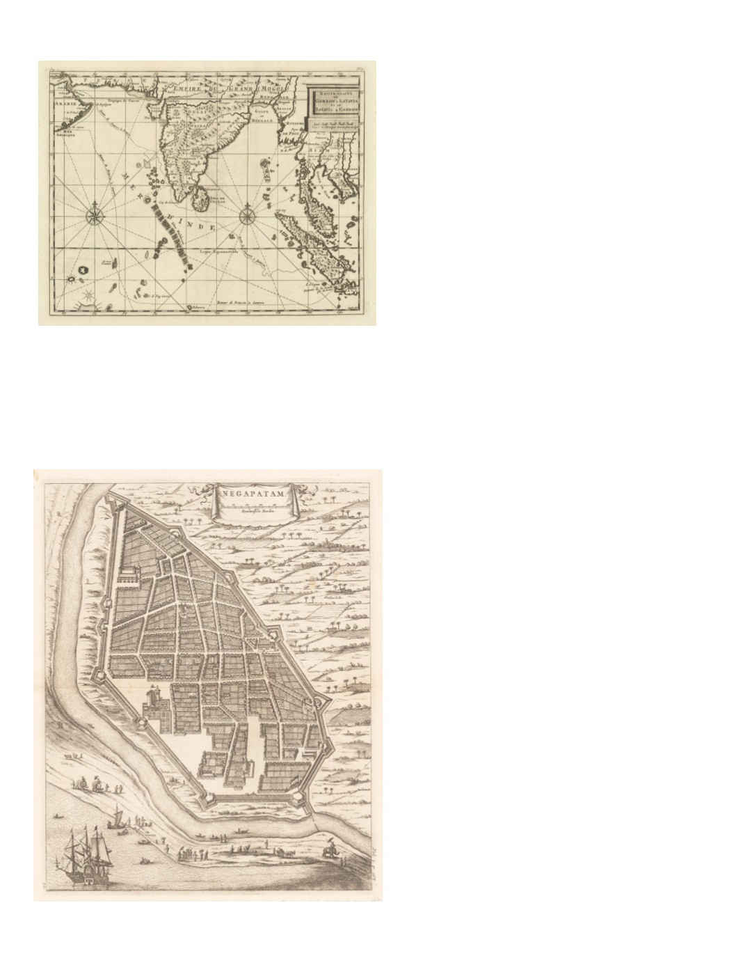
67) Route exacte de Gamron à Batavia et de Batavia à Gamron By: Cornelius de Bruyn (de Bruijn; Corneille le Bruin) Date: 1714 (circa) Delft Dimensions: 9.25 x 11.8 inches ( 23.5 cm x 30 cm) This attractive map extends from the entrance to the Persian Gulf in the northwest, across the equator to the tip of Java. The map illustrates the round-trip route of a voyage to Batavia, Java, from Gamron in the Persian Gulf. Gamron is the name of present-day Bandar Abbas, Iran. (It is derived from the Portuguese Cambarão and Porto Comorão; also known as Gombroon to English traders and Gamrun or Gumrun to Dutch traders.) The outward voyage takes a more northerly route via Cochin and Galle; the return voyage goes westward a long distance south of the equator, then veers northward to the coast of Oman. It provides an attractive conjectural depiction of mountain ranges in India, Ceylon (Sri Lanka), the Malay Peninsula, Sumatra, Thailand, and Cambodia. Some major seaports, rivers, and inland towns are marked. Condition: Excellent condition, clear dark impression $250India:
Cities, Forts & Harbors
68) Negapatam. By: Olfert (Olivier) Dapper Date: 1672 (published) Amsterdam Dimensions: 13.78 x 11 inches (35 cm x 28 cm) This detailed bird’s-eye view of Negapatam oriented to the west is the current location of Tata Nagar in present- day Nagapattinam, which served as the capital of Dutch Coromandel (in the Cauvery Delta) from 1660 to 1781. The map depicts several churches and public buildings in addition to a city wall and residential streets. A Dutch flag flies at the northeast corner of the wall. Along the coastal sandbar, separated from the town by the mouth of the River Kaduvaiyar, are depicted several charming scenes of activity, including three elephants with riders holding parasols, a bullock cart hauling goods, cowherds, rowers, Europeans waiting for launches to two Dutch ships anchored offshore at the lower left corner of the map. Outside the city walls are views of farms, water buffaloes, and palm trees. Title in top center of the map in a cartouche in the form of a curtain tied at the top of either end with ribbons. The scale in “Rynlandsche Roeden” is just below the title. Condition: Excellent condition displaying a sharp impression on clean paper with full margins. A few minor spots of light foxing are apparent. $350


