
56
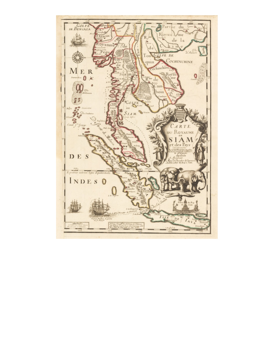
97) Carte du Royaume de Siam et des Pays Circonvoisins By: Placide de Sainte-Hélène; Engraved by Claude Roussel Published by: Mlle. Du Val, niesse de l’auteur Date: 1686 (dated) Paris Dimensions: 18.7 x 13.2 inches (47.5 x 33.5 cm) Title in splendid, large baroque cartouche adorned with olive branches and flanked by Asian men in robes and turbans. At the bottom of the cartouche are two elephants. A compass rose is in the upper left corner, above which is one of three French ships. Another to the west of Java is labeled l’Oiseau, a warship sent by the French king. Its route, under the command of Monsieur le Chevalier de Chaumont, is traced in a dotted line through the Sunda Strait (Selat Sunda) northward through the Gulf of Thailand to the region of present-day Bangkok. In the lower right, above the island of Java, is a depiction of the royal barge of the king of Siam. Extends from Burma and South China southward, including Indochina, the Malay Peninsula, Sumatra, and Java, along with the Andaman and Nicobar Islands and Hainan. Interior mountain ranges and some forests are depicted in addition to major rivers and sandbanks. Condition: Clear and strong impression on watermarked paper with original color. Repair with archival paper along the entire left margin, overlapping the line of the left margin. Small areas of foxing appear around top, right, and bottom edges, outside the margins. A stain of a drop of liquid is at the center of the bottom edge well beyond the margin. $17,500


